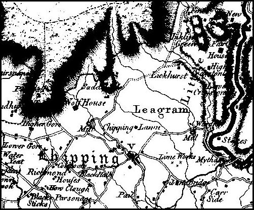
William Yates map, 1786
This map dated 1786 is part of the first properly surveyed map of all Lancashire. It was produced by the cartographer William Yates and his team. The surveying was done over a few years before the date of publication.
It gives a glimpse of Lancashire just before the widespread development of water powered factories in the Industrial Revolution.
Only one water mill is shown on Chipping Brook -ie – Wolfen Mill, then a corn mill.
Kirk Mill corn mill isn’t labelled, though the buildings seem to be shown. The mill may have been derelict at the time or being rebuilt to be turned into an Arkwright style cotton spinning mill by the new owners in 1785.
The V next to the word Chipping indicates the presence of a Vicarage.
Yates maps are on-line —
http://www3.lancashire.gov.uk/environment/oldmap/Yates/index.asp