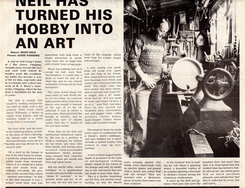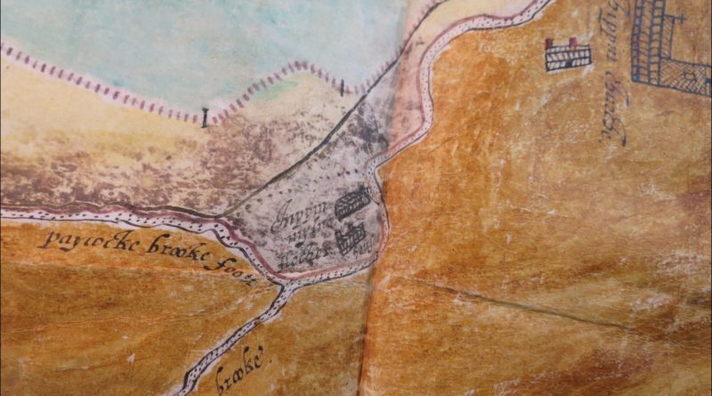
Roger Kenyon’s map, 1608
Copied here are greatly enlarged portions of a map of Leagram and adjoining areas, drawn by Roger Kenyon in 1608. It is the oldest map found so far which shows Kirk Mill.
The original map is preserved amongst Duchy of Lancaster documents in the National Archives [Public Record Office] in London.
Ref. TNA DL 4/54/54.
The map relates to a dispute about the Leagram deer park boundary (the pale) shown by the line of upright strokes.
It was drawn up as an aid to Commissioners who were seeking evidence about the correct route of the pale. Occupiers of properties around the pale boundary are named, indicating who could be called as witnesses.
The western edge of the park, coloured blue, adjoined the Kirk Mill property.
Chipping church is shown on the right.
Paycocke Brook is an earlier name for Dobson’s Brook.
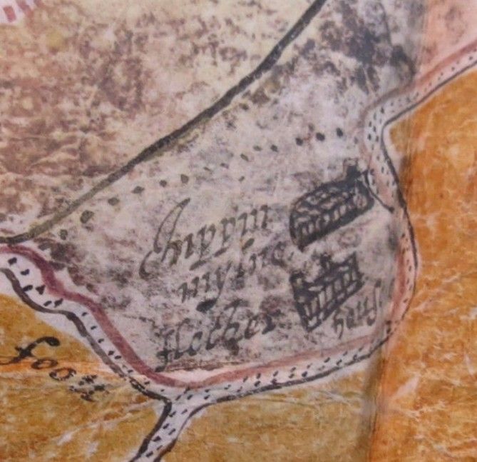
Buildings are shown, merely as landmarks. It is unlikely they were mapped accurately – for instance, there’s no mill pond shown at Kirk Mill.
“Chippin mylne” is Kirk Mill corn mill. “Fletcher House”, indicates the occupant there at that time.
This more enlarged map shows there may have been an attempt to detail differences between the buildings – chimneys are shown on the house whereas there seem to be none on the mill.
Thanks to Dr Bill Shannon who located the map in London in the course of his research into Tudor disputes.
Thanks also to Dr Graham Cooper who drew the attention of people in Chipping and Leagram to the map. Dr Cooper and a team of several volunteers researched the dispute, the deer park and the 1608 map. They produced a report which was published in Sept 2014 by the Forest of Bowland Area of Outstanding Natural Beauty.
http://forestofbowland.com/Medieval-Deer-Parks-Bowland
in particular —
http://forestofbowland.com/files/uploads/pdfs/cooper_deer_salters_in_leagram_park_v1.pdf
The “new” chair factory at Kirk Mill was set up in the late 1940s on a field often referred to locally as Sooter, Souther, Sawter Field / Croft. In the official corn mill deeds for centuries, this field was called Salter Croft. As Dr Cooper explains, it’s very likely the field name indicates there was a deer jump [salter] in the nearby park pale.